Bakken/Exshaw Crude Oil Map
Laminated 24" x 36" Bakken/Exshaw Crude Oil Wall Map
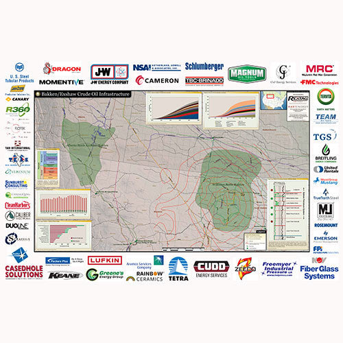
The Bakken/Exshaw wall map outlines the main geologic features of the region and the major crude-oil infrastructure. Insets detail the rig counts in the Bakken/Three Forks, and also illustrate the top acreage holders in the resource plays.
Crude Oil Infrastructure:
-Production Forecast by Operator through 2019
-Stratigraphy for NW and SW Montana
-Rig Count
-Top Acreage Holders
-Type Log, Bakken Petroleum System, Williston Basin
-Crude Oil Transmission Pipelines
-Proposed Crude Oil Pipelines
-Railroads
-Structure Contours, base of Mississippian
-Play Extent
-Crude Oil Refinery