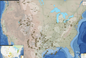
U.S. Natural Gas Liquids Infrastructure Map
The U.S. Natural Gas Liquids Infrastructure Wall Map is the premier illustrated guide to the NGL/LPG/HVL pipeline systems of the country. In addition to the pipeline systems, the map provides the most informative look at the processing capabilities of the country’s petro-chemical facilities and processing plants.
The redesigned U.S. Natural Gas Liquids Infrastructure Wall Map contains the following features:
-
NGL/LPG/HVL Pipelines (labeled with operator name and commodity)
-
Natural Gas Processing Plants (labeled with name and capacity)
-
Proposed Natural Gas Processing Plants (labeled with name and capacity)
-
Major Petrochemical Plants
-
Oil & Gas Basins (labeled names)
-
Informative charts related to the Liquids market
Last updated in 2020
